
The rapid growth of distributed photovoltaic generation is increasing the need for reliable information on how much solar electricity is being produced now and how production will evolve over the next hours and the following day. This information is important for grid operation, energy management and the integration of variable renewable generation, but it is difficult to obtain when production measurements are incomplete, delayed or available only for part of the installed fleet.
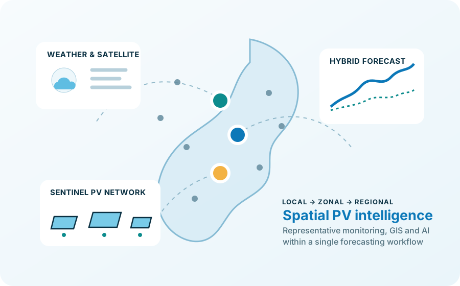
SentinelPV develops a research framework that reduces this observability problem to a more manageable one. Instead of assuming that every PV installation must be monitored in real time, the project identifies a limited set of representative monitored systems — the sentinel PV plants — and studies how their information can be used to describe larger geographical areas.
Objectives and ambition
The project aims to develop a robust and scalable methodology for forecasting photovoltaic generation over large regions. The objective is not simply to improve the forecast of a single plant, but to understand how local observations, meteorological conditions and spatial relationships can be combined to infer the behaviour of a distributed PV population.
A central research question is the definition of the appropriate spatial resolution. Very fine spatial partitions can preserve local variability but require more monitoring and computation; very coarse areas are easier to manage but may hide important differences in weather and PV behaviour. SentinelPV therefore searches for a practical balance between forecast accuracy, spatial detail and monitoring effort.
Three complementary research dimensions
Representative monitoring
The first dimension concerns the selection of sentinel systems. PV plants are analysed not only according to their geographical position, but also through historical production patterns, local meteorological variability, terrain characteristics and, when available, relevant technical information. The goal is to identify observation points that are statistically meaningful for the areas they represent.
Hybrid forecasting
The second dimension combines physical and data-driven modelling. Deterministic PV models provide physically interpretable estimates based on solar irradiance, module temperature, geometry and system characteristics. Machine-learning models are then used to learn nonlinear temporal relationships, spatial dependencies and residual patterns that cannot be captured easily by a purely deterministic formulation.
Spatial visualisation and decision support
The third dimension is the web platform. Forecasts, historical data and intermediate spatial results are integrated into an interactive GIS environment. The platform is conceived both as a research demonstrator and as a way to make the forecasting process more transparent, allowing users to connect the final prediction with the geographical data and model comparisons behind it.
Pilot region and scalability
The methodology is developed and validated in Piemonte, where the project can combine a heterogeneous territory, distributed photovoltaic generation and multiple sources of meteorological and geospatial information. The architecture is intentionally modular so that the same concepts can later be transferred to broader national and European applications and, in future developments, extended to other variable renewable energy sources.